
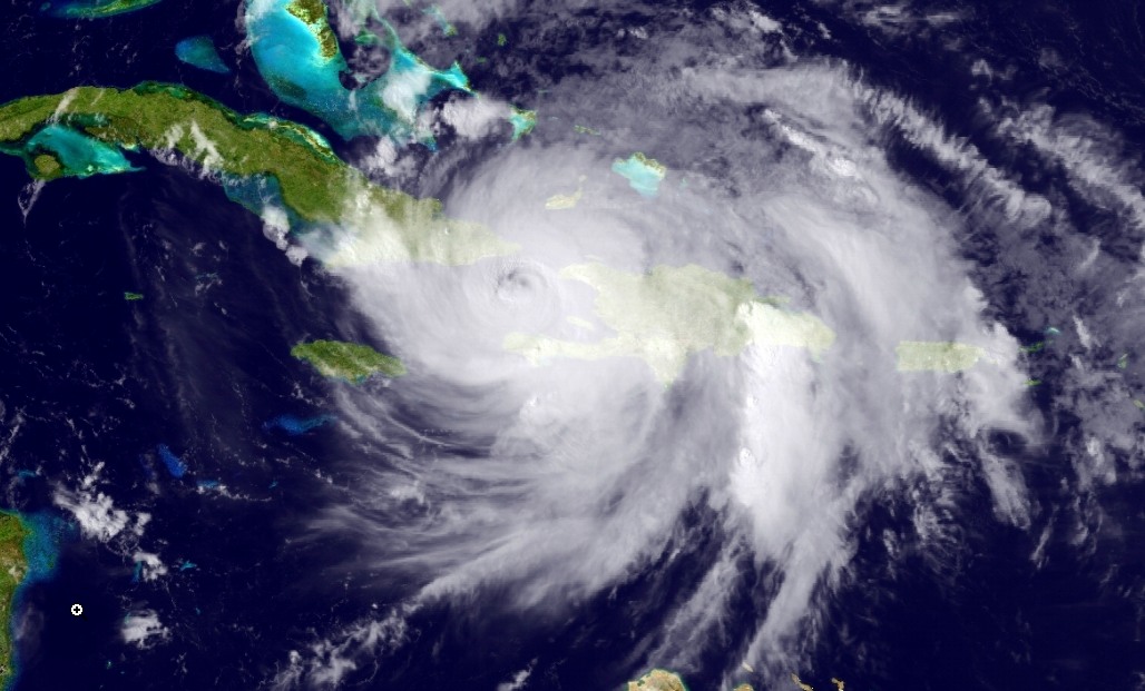
Enlarge / A GOES Satellite image of Matthew taken at 4:43pm ET on Tuesday, (credit: NOAA)
Early on Tuesday, Hurricane Matthew ravaged Haiti and eastern parts of Cuba with winds of up to 145mph, and it appeared likely to do the same to the Bahamas on Wednesday. Beyond that point, considerable uncertainty remains in the storm’s track as it moves northwest toward Florida. But arguably the world’s best weather model, the European forecast system, now suggests a potential landfall along, or a significant grazing of, Florida’s space coast.
The 12z operational run of the European model, which was initialized Tuesday morning and finished running early in the afternoon hours, shows a weaker trough of low pressure over the Great Lakes region affecting Matthew, allowing the hurricane to follow a slightly more westerly track. The model actually brings the storm’s center ashore on the Florida coast near Cocoa Beach, Florida, and the Kennedy Space Center on Friday morning. Although hurricane forecasts can vary significantly from run to run, with less than three days before such a landfall, this seems to be a plausible outcome.
Ars reached out to Kennedy Space Center’s Amber Philman on Tuesday afternoon, and she said the center is currently at HURCON III status, which means officials there expect sustained 50 knot winds within 72 hours. Hurricane preparations and facility securing will begin Wednesday morning, she said. Most of Florida’s east coast is presently under a hurricane watch, according to the National Hurricane Center.
Read 3 remaining paragraphs | Comments
Source: Ars Technica – Hurricane Matthew poses a significant threat to Kennedy Space Center