
Enlarge (credit: NASA Earth Observatory)
Mark it down, Arctic sea ice watchers: the US National Snow and Ice Data Center (NSIDC) has (preliminarily) called the annual minimum ice extent. On September 10, Arctic sea ice coverage dipped to 4.14 million square kilometers (1.6 million square miles) before ticking back upward for a few days. While it’s possible that a couple more days of shrinkage could come along, that was probably the low point for the year.
That puts 2016 in second place for the lowest minimum on record—statistically tied with 2007, which was within the error bars of this year’s data. The record low is retained by 2012, which fell to an incredible 3.39 million square kilometers. This continues the trend of marked decline observed by satellites since 1979.
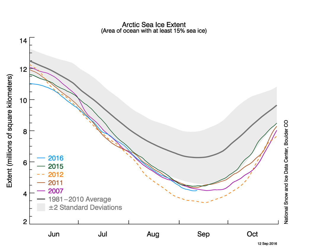
(credit: National Snow and Ice Data Center)
The ice was a little harder to track than usual this time around. Earlier this year, the Defense Meteorological Satellite Program satellite used by the NSIDC to track Arctic sea ice went on the fritz. After careful calibration, they switched to the next satellite in the series, bringing daily updates back online a couple months later and ensuring that there was no gap in the record.
Read 4 remaining paragraphs | Comments
Source: Ars Technica – Arctic sea ice coverage is at its 2nd lowest on record