
Enlarge (credit: Bernard Gagnon via Wikimedia Commons)
By combining old and new aerial images, archaeologists are getting a new look at the complexities of supplying water to an ancient desert city.
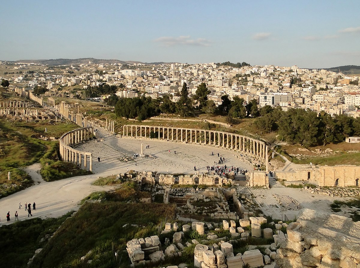
In northern Jordan, along a wadi once called the Golden River, the ancient city of Jerash sits uneasily alongside its modern namesake. With its columned temples, Roman forum, and other monuments, it’s one of Jordan’s biggest tourist attractions and a key to the region’s long, complex history. But the expansion of modern Jerash is slowly destroying what remains of the old city.
Recently, a team of archaeologists from Aarhus University and Münster University combined historical aerial images with modern, laser-scanning surveys to map those changes and get a big-picture view of the ancient city. Previous archaeological work at Jerash have mostly focused on individual sites, or on standing monumental architecture, rather than more subtle or mundane aspects of city life, even though the latter is what kept its residents alive. Comparing modern laser scans with aerial photos spanning the last century let them identify what has been lost, which sites are most at risk, and make connections between features that might have been much harder to recognize from the ground.
Read 20 remaining paragraphs | Comments
Source: Ars Technica – Decades of aerial photos reveal how an ancient desert city got its water