
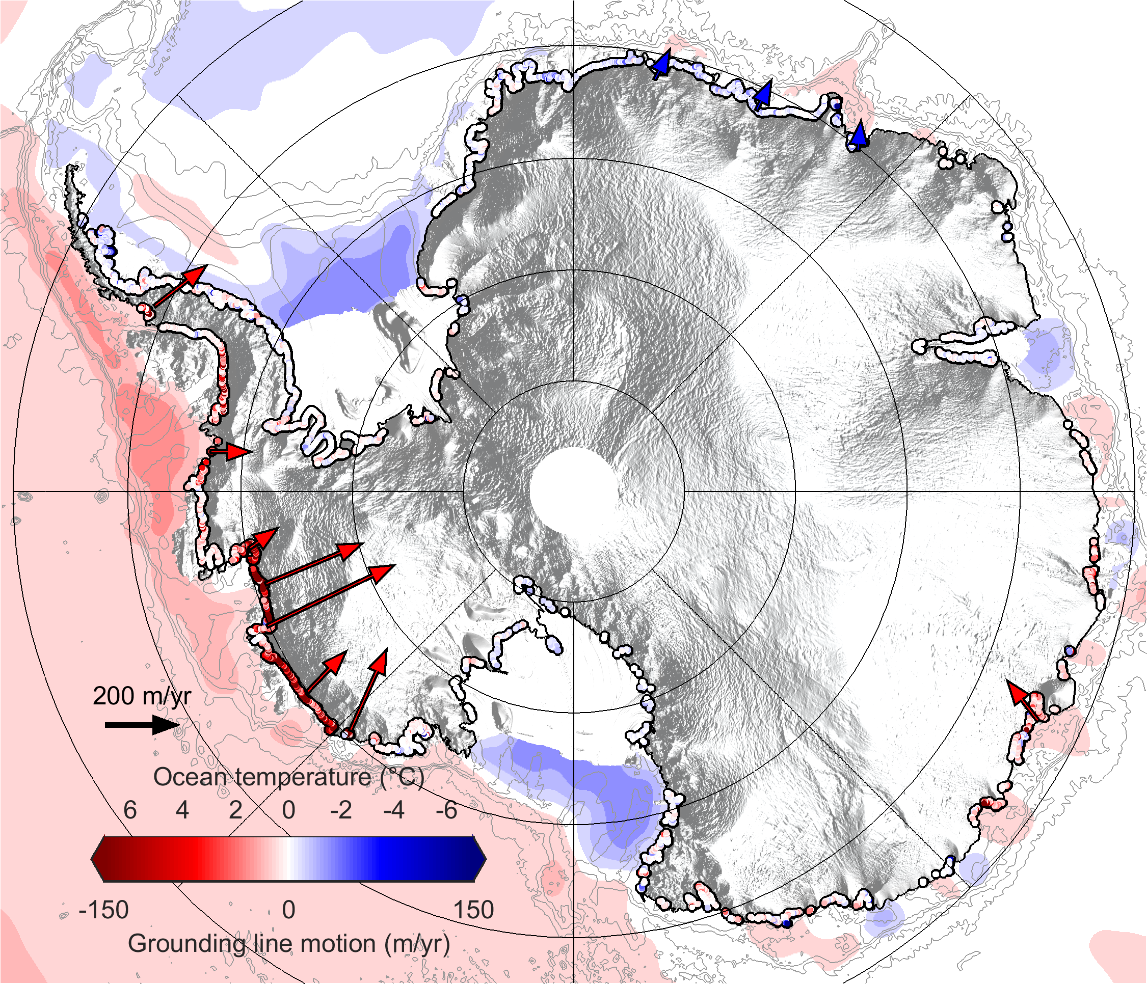
Enlarge / Migration of glacier grounding lines between 2010 and 2016, with ocean temperatures. (credit: Hannes Konrad et al., University of Leeds)
If Antarctica and Greenland were just big ol’ ice cubes, projecting future sea-level rise would be a snap. The physics of ice melting are simple when you know the temperature. But these frozen continents are not nearly as boring as a cube of ice, so the task of working out how fast they will melt over the next century (and beyond) is herculean in scope.
Antarctic ice flows like slow putty, sliding away from the high interior of the continent and toward the sea. Some “outlet glaciers” at the edge fall apart before they hit the shoreline, but most push out into the water to produce floating ice shelves. The point where the ice lifts off the ground and begins to float is called the “grounding line,” and it’s incredibly important to a glacier’s stability.
A new study led by Hannes Konrad of the Alfred Wegener Institute greatly expands the map of Antarctica’s grounding lines, tracking areas of change and areas of stability.
Read 10 remaining paragraphs | Comments
Source: Ars Technica – Satellite tracking of Antarctica expands view of glacial patchwork