
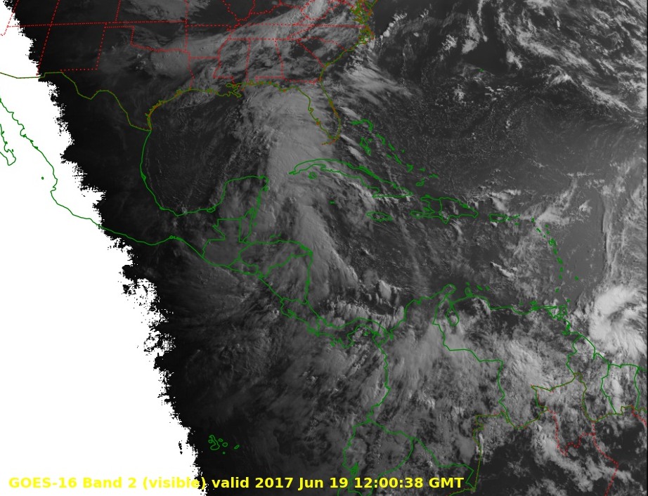
Enlarge / This preliminary and non-operational GOES-16 visible image shows two tropical systems, one near the Gulf of Mexico, and the other northeast of South America. (credit: NOAA)
Although the Atlantic hurricane season begins June 1, the bulk of the tropical activity typically clusters during the middle months of August, September, and October when the seas reach their peak temperatures. This year has already been unusual, however, with the formation of highly rare tropical storm in April—Arlene, which meandered around the open Atlantic Ocean for a few days.
Now, the tropics are becoming active again. For several days the National Hurricane Center has been calling attention to two systems, one near the southern Gulf of Mexico, and the other to the northeast of Venezuela in the Atlantic. Both systems have a 90 percent chance of becoming a tropical depression or storm, according to hurricane forecasters at the Miami-based center.
For interests in the United States, the storm moving into the Gulf of Mexico today presents a legitimate threat. Although conditions in the Gulf are generally unfavorable for significant intensification, the system is producing a large area of showers and thunderstorms across its eastern half, and it could bring a major flooding event to the Gulf coast, somewhere from Texas to the Florida panhandle, later this week. The second storm seems likely to be blown apart later this week by hostile conditions as it moves westward into the Caribbean Sea.
Read 2 remaining paragraphs | Comments
Source: Ars Technica – Atlantic faces the rare prospect of two active tropical storms in June